Flight time from Kandahār to Ashgabat
How long is the flight time from Kandahār to Ashgabat?
The flight time between Kandahār and Ashgabat is 1 hours 23 minutes.
What is the Flight Distance Between Kandahār and Ashgabat?
The flight distance from Kandahār (Afghanistan) to Ashgabat (Turkmenistan) is 604 miles or 971 kilometers or 524 nautical miles.
The calculated distance between two cities is the straight flight distance measured from one point to another by air. The nearest airport to Kandahār is Islamabad International Airport (ISB) and the nearest airport to Ashgabat is Ashgabat International Airport (ASB).
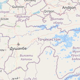
Map of flight path from Kandahār to Ashgabat
The map of the shortest flight path between Kandahār, Afghanistan and Ashgabat, Turkmenistan is displayed below.
                   Leaflet | © OpenStreetMap |
Kandahār Details
Kandahār is located in Afghanistan.
| GPS Coordinates | Latitude: N 31° 36' 48'' Longitude: E 65° 42' 36.5'' |
|---|---|
| Latitude | 31.61332 |
| Longitude | 65.71013 |
| Country | Afghanistan |
Ahmad Shah Baba International Airport / Kandahar Airfield (KDH)
Ashgabat Details
Ashgabat is located in Turkmenistan.
| GPS Coordinates | Latitude: N 37° 57' 0'' Longitude: E 58° 22' 60'' |
|---|---|
| Latitude | 37.95 |
| Longitude | 58.38333 |
| Country | Turkmenistan |
Ashgabat International Airport (ASB)
Time Difference between Kandahār and Ashgabat
Time difference between Kandahār (Afghanistan) and Ashgabat (Turkmenistan) is 0 Hours 30 Minutes.
Ashgabat time is 0 Hours 30 Minutes ahead of Kandahār.
Ashgabat time is 0 Hours 30 Minutes ahead of Kandahār.
| Current local time in Kandahār | Current local time in Ashgabat |
|---|---|
| 2025-09-23, 04:55:10 +0430 | 2025-09-23, 05:25:10 +05 |
Popular Searches from Kandahār
Popular Searches from Ashgabat
Please add a bookmark (press CTRL+D to add) and share the page with your friends!