Flight time from Novokuznetsk to Malabo
How long is the flight time from Novokuznetsk to Malabo?
The flight time between Novokuznetsk and Malabo is 12 hours 43 minutes.
What is the Flight Distance Between Novokuznetsk and Malabo?
The flight distance from Novokuznetsk (Russia) to Malabo (Equatorial Guinea) is 5534 miles or 8905 kilometers or 4805 nautical miles.
The calculated distance between two cities is the straight flight distance measured from one point to another by air. The nearest airport to Novokuznetsk is Novosibirsk Tolmachevo Airport (OVB) and the nearest airport to Malabo is Nnamdi Azikiwe International Airport (ABV).
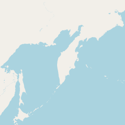
Map of flight path from Novokuznetsk to Malabo
The map of the shortest flight path between Novokuznetsk, Russia and Malabo, Equatorial Guinea is displayed below.
                   Leaflet | © OpenStreetMap |
Novokuznetsk Details
Novokuznetsk is located in Russia.
| GPS Coordinates | Latitude: N 53° 45' 20.5'' Longitude: E 87° 6' 35.6'' |
|---|---|
| Latitude | 53.7557 |
| Longitude | 87.1099 |
| Country | Russia |
Malabo Details
Malabo is located in Equatorial Guinea.
| GPS Coordinates | Latitude: N 3° 45' 20.8'' Longitude: E 8° 46' 54'' |
|---|---|
| Latitude | 3.75578 |
| Longitude | 8.78166 |
| Country | Equatorial Guinea |
Time Difference between Novokuznetsk and Malabo
Time difference between Novokuznetsk (Russia) and Malabo (Equatorial Guinea) is 6 Hours.
Malabo time is 6 Hours behind Novokuznetsk.
Malabo time is 6 Hours behind Novokuznetsk.
| Current local time in Novokuznetsk | Current local time in Malabo |
|---|---|
| 2025-11-29, 00:13:15 +07 | 2025-11-28, 18:13:15 WAT |
Popular Searches from Novokuznetsk
Popular Searches from Malabo
Please add a bookmark (press CTRL+D to add) and share the page with your friends!